Matt Hural and Jeff Williams

September 6, 2010

When Matt Hural came for a visit to New York in September,

Jeff Williams and I knew we had to do something special.

We all met in Italy a few years before,

and we had adventured together from the deserts of Tunisia,

to ancient sewers under Rome.

Where could we go in New York with Matt?

Jeff Williams had an idea.

It was somewhere he had always wanted to go, too.

So we piled into the boat at dawn,

and headed up the Hudson River.

You may have seen this from the Hudson River Drive,

just around West 63rd street,

a huge old pier crumpled up in the river.

This was the old New York Pier D,

built of wood in the 1880’s,

rebuilt in steel after a fire in 1922,

and then finally abandoned in 1971.

Apparently its sloped floor had something to do with loading ships from trains,

although it was probably never this sloped.

I found out a few months later that the pier was removed by the city parks department.

Here is the New York Times article about it’s demolition.

We might have been some of Pier D’s last visitors.

Jeff had been referring to it as the Gordan Matta-Clark pier, and we absorbed our surroundings as if we were viewing a huge sculpture.

The sun was getting higher,

as we headed back to shore.

Matt took a little chunk of pier D with him in his knee,

and Jeff took a little hook as a souvenir.

We didn’t realize as we floated away,

that this was the last time any of us would see this New York landmark.

We wanted to make one more stop before breakfast.

The 69th Street Transfer Bridge.

It is on the National Register of Historic Places,

so it probably won’t be demolished any time soon.

But you might want to pay a visit anyway,

you never know how long these things will last.

Clay Risen and Leslie Synn

August 15, 2010

There is one island in New York that I have always read about but never visited.

So when Clay Risen said he wanted to see Shooters Island,

we started to plan a trip,

along with his friend Leslie Synn.

We found a place to launch from Staten Island,

that appeared on maps to be close to Shooters Island.

When we came out of the docks, the island was right in front of us. “Almost too close,” I thought, “where is the adventure in that?”

I had no idea what we would see on the island.

The whole island was once a great shipyard,

and you can see how much bigger the land mass must have been in the early 1900’s when the docks were active.

The tide was extremely low, so we walked the perimeter of the island.

We begin to spot fragments of glass and porcelain in the debris;

small jars,

and old plates.

Every bit seemed to tell a story.

It must have been washed out of landfills along the Arthur Kill Waterway.

This baked enamel AT&T sign must be over 100 years old.

The whole beach was like a time capsule.

As we were looking down at the sand and trash,

a huge barge had slipped up to the island without a sound.

We were treated to a wonderful sight;

two tugboats nudging the massive tanker into a 180 degree turn, like two tiny parents preparing their over-sized child for a transatlantic journey.

We got all of our loot into the boat,

and set off to explore the rest of the island.

In the early 1900s the Townsend-Downey Shipbuilding Company built racing yachts here.

Then the industry changed to cargo vessels,

and I read that during WW I, nine thousand men were employed on the island.

Now it is a refuge for herons, egrets, cormorants, and ibis.

We can see their nests high up in an old crane like a 4 story condo for birds.

The dry-docks themselves are massive, weathered, and worn, but standing upright,

and we climbed aboard to see what they were made of.

It is no wonder these things are still standing while everything else has broken and rotted away;

the docks are braced with solid timber all the way through.

The planks are two feet across in some places and almost as thick.

I think the birds will have a safe home for a long time.

We paddled back around the island,

and headed across the Kills to Staten Island.

We had left Brooklyn before the sun came up,

and I was ready for a nap.

On the way home in the truck, we made a short stop in front of Leslie’s house.

It was time to divide up the loot.

Clay, Leslie and I went through all the glass and shards of porcelain,

each picking out what we wanted to keep.

There were some difficult choices and tough bargaining,

but in the end, we were all very happy with our selections of trash.

Jean Barberis and Georgia Muenster

August 12, 2010

Early on Sunday morning I went with Jean and Georgia to one of the most fantastic places in New York;

The Staten Island Boat Graveyard.

For a mile and half,

the Arther Kill Waterway, which separates Staten Island from New Jersey,

is filled with the rotting remains of hundreds of scuttled vessels;

houseboats,

barges,

ferries,

and fishing boats,

the ships seem to be frozen in the process of sinking.

It is wonderfully eerie to paddle a little boat in and out of the wrecks;

like the whole world is standing still.

As we floated through the tangle of debris,

Jean and Georgia were quiet and thoughtful.

You see, this was not an ordinary ‘Tide and Current Taxi’ mission,

and these participants were not an ordinary crew.

We were on an important scouting mission.

Jean and Georgia are members of a collaborative art endeavor called the Flux Factory,

and one of their projects this summer is a series of tours that they call ‘Going Places (Doing Stuff)’.

We were out on the boat that morning to see if The Staten Island Boat Graveyard could be one of the places.

It would take a lot of coordination to get 30 people in small boats out to see the graveyard,

but this is the sort of thing that the Flux Factory seems to specialize in.

And they knew some other boat makers, like Mare Liberum, who might be able to help.

We had to find a place to get 30 people down to the water and into the boats,

so we began exploring water routs along the highway,

and under the highway.

As we planned the tour we started to get excited on behalf of the future participants.

We imagined how happy they would be, riding through a sewer,

on the way to a massive boat dump!

Real adventure in New York City – we thought.

And it was!

To see images of the Flux Factory Tour click here.

Andrea Hill and Paul Jacobsen

August 10, 2010

Andrea, Paul and I have been planning to go out in the boat since last winter. They said that they were house sitting in Red Hook, so I suggested that we take a trip in the Gowanus Canal.

We set out early and the tide was higher than I have ever seen in the Gowanus. In some places it actually was coming over the bank.

Up ahead something strange was happening in the water; a large upwelling, as thought huge amounts of water and air were coming right up from the bottom.

By the time we paddled past there was only foam.

We asked a man on the bridge if he had seen the upwelling. He turned out to be the right person to ask. He was monitoring the water quality after some new aeration pipes were set into the canal. “That is probably some pressure being released in the pipes. I would steer clear of it.” he said.

“Do you think those pipes will work?” We asked. “Well right now they are working a little too well.” We paddled carefully past his monitoring equipment,

and maneuvered around a floating containment boom that seemed to be containing a lot of sludge.

At the end of the canal we could see the new pipes and facilities that are aerating the water.

It looked just like a washing machine for water,

and we could see part of the Gowanus Canal swirling around inside through a little window.

Along the way, Paul told us stories about growing up in the area.

It turns out that he grew up just a few blocks away.

“Did you ever come down here as a kid?” I asked.

“Not really,” said Paul. “We mostly hung out in abandoned lots.”

I guess the canal smelled even more gross 20 years ago.

We all marveled at how different everything looks from the water.

There seemed to be so much activity along the banks:

cement mixers,

getting ready to move into the city,

and barges filling up with trash.

I realized that I am usually out on the weekend and now here we were in the middle of a working canal on a busy week day morning.

Presently, we floated into a huge oil spill.

We sat mesmerized by the patterns on the surface of the water.

Our conversation turned naturally to the situation in the Gulf of Mexico.

As we left the last bridge in the Gowanus,

and paddled out into the bay,

a light rain had begun to fall.

I thought I knew a shortcut,

so we slipped under a low pier.

My friend Andrew Sloat showed this to me years ago.

We came out on the other side into a barge parking lot.

It was strange being in so close with huge ships.

I tried not to be nervous as I thought about them nudging up against each other in the water.

We paddled past a pretty tug,

and we were out in the open water again.

Andrea pointed out her house, you could just see the building where she lives on the southern tip of Manhattan.

The water seemed clear and smelled like the ocean out here, not like where we started out.

We could see the Statue of Liberty across the bay,

and further out the barges line up to drop off cargo.

“That is where ‘Real World: Brooklyn’ was filmed.” said Paul.

“Now the whole world is the ‘Real World’.” I thought.

There is a little beach at the end of Paul’s mom’s street,

where they were house sitting,

along with Paul’s pet rabbit.

Paul showed me a painting that he made. He described it as an indoor Utopian landscape.

“When I painted it 8 years ago, I didn’t think that it was possible. Now I think we can do it.” he said.

“Thanks for taking us out!” said Paul and Andrea. “Thank YOU!” I said, “I learned so many new things about Red Hook!”

William Van Dorp and Debbie Tuch

August 9, 2010

I have been reading William Van Dorp’s blog ‘Tugster‘ for years, and we finally scheduled a boat ride together.

My friend Debbie Tuch came along as well. Although Debbie has never been in the “Tide and Current Taxi” she has been an important part of my boat projects throughout the years.

Somehow, everyone agreed to meet at 7 am, and it was a beautiful morning.

We started seeing the ‘Ghost Shipsof Coney Island’ right away, drifting up out of the water like skeletons.

This is the strangest thing out here; a submarine half stuck in the mud. The first time I saw it, I couldn’t even figure out what it was.

But I soon found out that it was built to look for treasure on the Andria Doria. We filled Debbie in on it’s strange story.

“Even if it worked, they wouldn’t have found anything.” said Will.

The great thing about being out in the water with Will, is that he knows everything about the harbor;

all the famous boats and wrecks.

He picked things out of the rotting timber as though he were reading an old book in some strange language, and told us what this might have been.

Each piece of twisted wood and iron was like a hieroglyph.

Then we came across something very unusual; a perfect meadow inside of a sunken barge.

Like a sunken ‘Smithson Barge’, I thought.

We began to see more recent wrecks. “Recession casualties.” I joke. “This is going to be more interesting than I even thought.” said Will.

At the mouth of the creek we ran into trouble. “An oil boom,” said Will. “This is the type of thing they are using in the gulf to trap oil and debris on the surface of the water.”

We slipped around the side of the boom,

and let ourselves into the Coney Island Creek.

There was something new along the bank. Will told us it was called a ‘Sponge Park’; an attempt to soak up toxic runoff before it gets into the creek.

We saw Greater and Lesser Egrets, Cormorants and Herons. Will told us about a time he saw a cormorant fishing under water right off the East River Esplinade in Brooklyn.

You’ll have to look at William’s blog to see pictures of the birds. My camera turns them into tiny smudges.

We came to the end of the creek and sat for a while in the hum of traffic, no one really wanted to turn back right away.

We saw bridge painters on the way back, pulling their rafts along under the bridge with long lines, hard at work on a Monday morning.

The tide had gone out, exposing more of the wrecks.

Will wanted to get up close to study to each one.

The metal was so thick and weathered that it looked almost like wood in some places.

The outgoing tide was slowly revealing an alien landscape.

The yellow submarine looked like it was ready to launch.

Will pointed out and H-bitt sticking out of the water and as he explained its use, he realized that we were right on top of an old tug boat.

Here we are with the ‘Tugster’ himself. If you want to see really good pictures of the day – or just about anything else in the New York Harbor, visit the website of one of it’s biggest fans.

Constance Hockaday and Mare Liberum

June 27, 2010

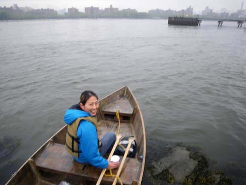
I met Constance Hockaday in Dumbo where she was doing a project about the waterfront.

She wanted to explore the banks of the East River,

and agreed to meet me just an hour after sunrise when the tide was heading North.

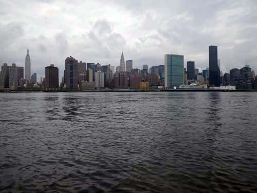
Daybreak is my favorite time to be out on the water;

no waves or wind and not another boat in sight.

Connie was visiting from Portland where she had just completed a degree in Participatory Community Development and Visual Art.

We ‘met’ online when she sent me pictures of a beautiful raft that she had made in Portland.

She was inspired by the Floating Nutrinos, who docked for a while in her home town when she was young.

“They changed my life.” she said.

I had the sense that throughout her education and participation in various art projects, Connie has been looking for the slapdash adventure and warm community that the Floating Nutrinos expressed so well.

While in New York, Connie is participating in a show at the Smack Melon Exhibition Space about artwork that contains a social element.

For her contribution, she has planned a meeting on the water between the two of us and two members of the art and boat making group Mare Liberum.

I have never met them before, but I have always been interested in their project.

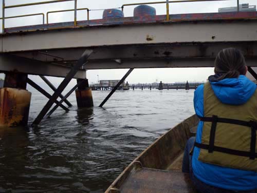
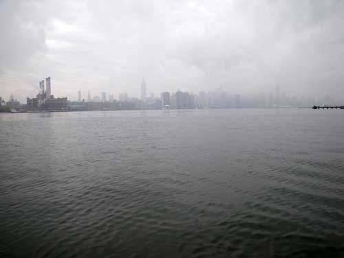
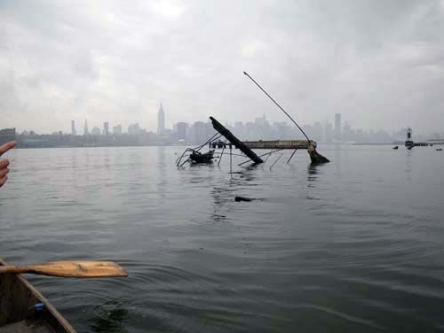
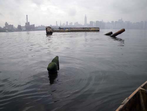
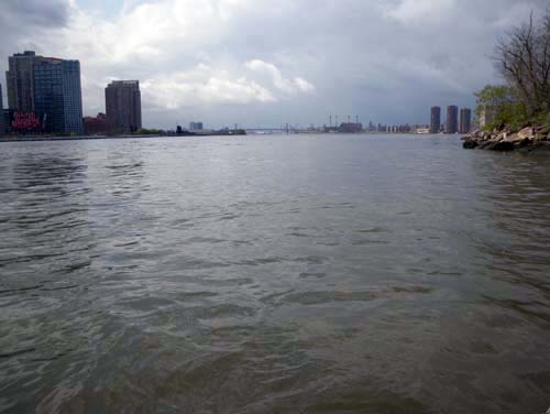
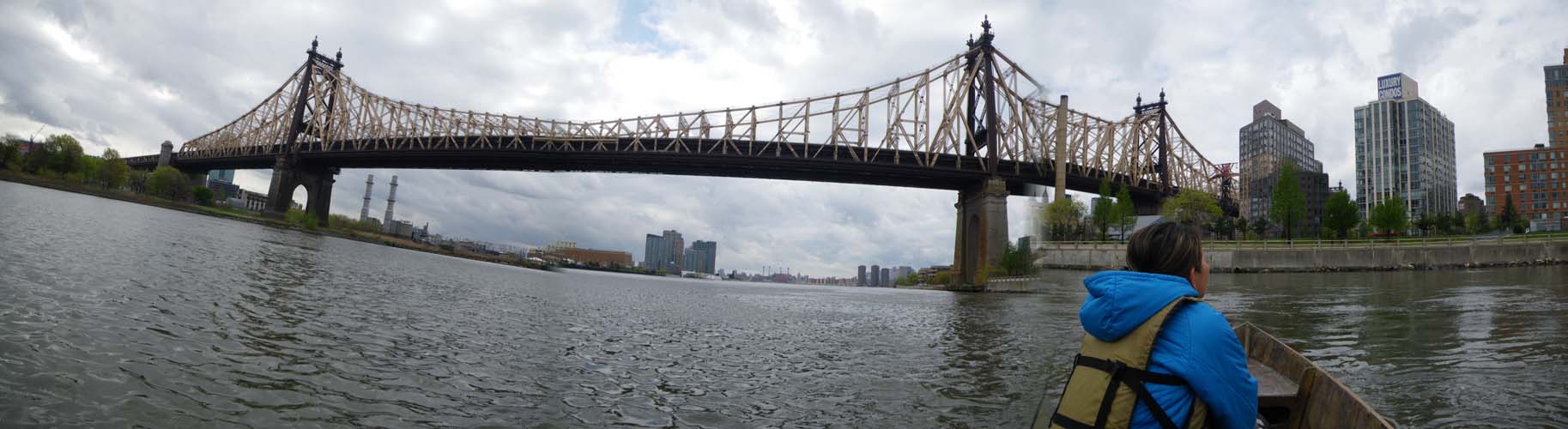
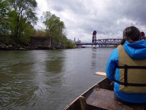
We had a few hours before our scheduled meeting, so we floated slowly North.

The tide was so strong around the Williamsburg Bridge, that a huge, smooth mound of water was being pushed up in front of the pier.

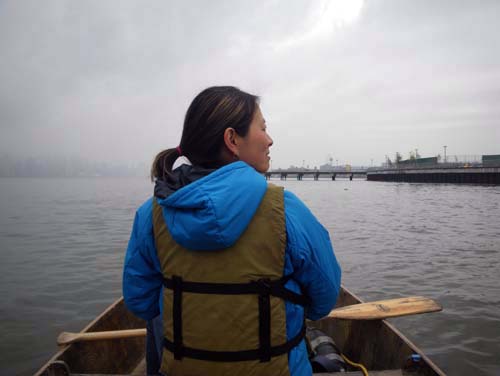
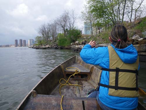
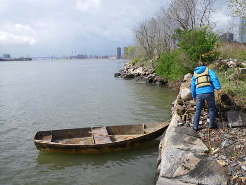
Connie climbed up to have a look around.

I was nervous about the strong eddies around the bridge that were making it hard to control the boat.

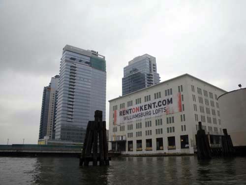
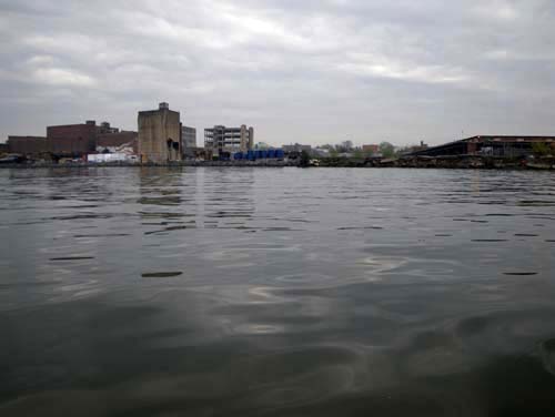
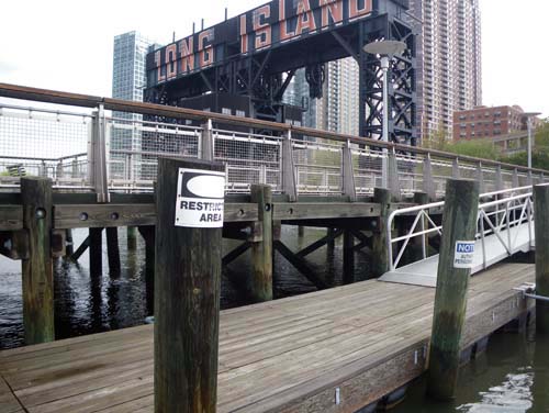
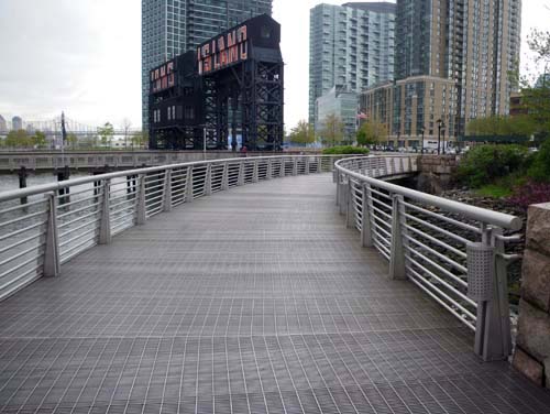
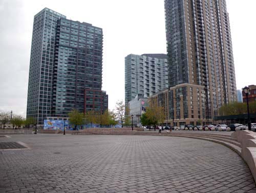
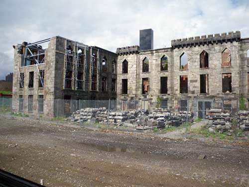
We floated past the Domino Sugar Plant, which I heard has been approved for development soon,

and into Williamsburg.

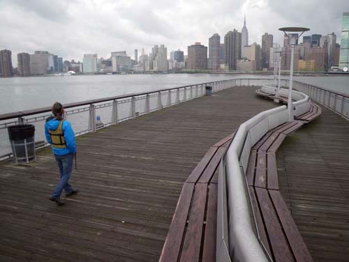
What a better way to experience the coast of Brooklyn,

than coffee at a nice market in Williamsburg (the only thing open at this hour).

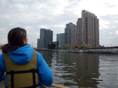
Back out on the water,I told Connie about all the abandoned warehouses that used to be here just 5 years ago,

and I relayed some stories that my neighbor told me about the Greenpoint piers in the 80’s.

Why do we love this stuff that is just disappearing before our eyes, we wondered.

I have always thought that it was exactly that; the temporariness of the waterfront environment that makes us love it.

Connie has been up this stretch of water before.

She participated in a project called the Swimming Cities of Switchback Sea,

and she told me all about exploring in the boats and the other places they have been.

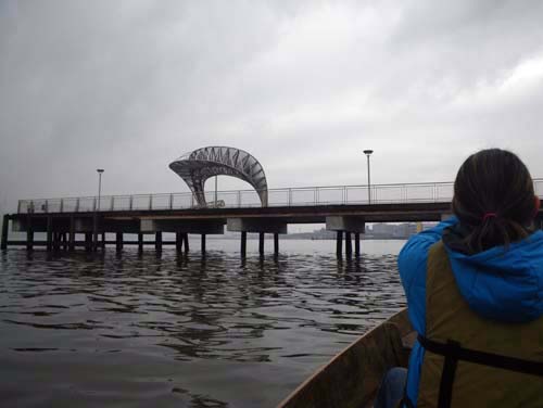
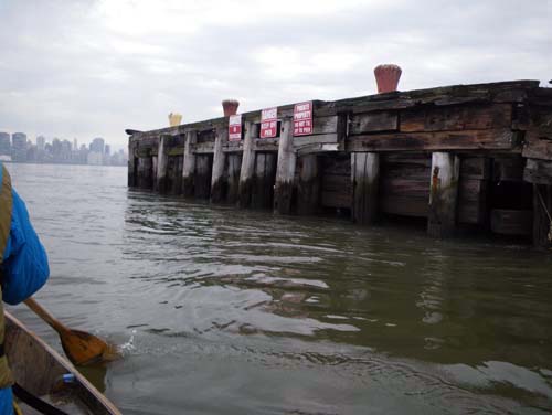
We just made it under the Huron Street Pier.

“This is the best place ever!” said Connie.

Connie spotted Benjamin Cohen off in the distance.

And we pulled up to one of the  pretty plywood dory’s made by the collective Mare Liberum.

We inspected each others boats,

and talked about various attributes of caulks and adhesives.

“Construction adhesive,” Ben confided “Is the very best marine sealer on the market. $4.82 a tube.”

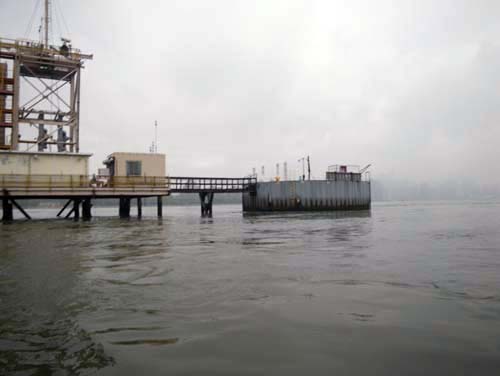
We followed him into the Newtown Creek to pick up Stephan von Muehlen, another member of Mare Liberum.

They tell us about the groups beginnings and how they have amassed a fleet of dory’s around New York.

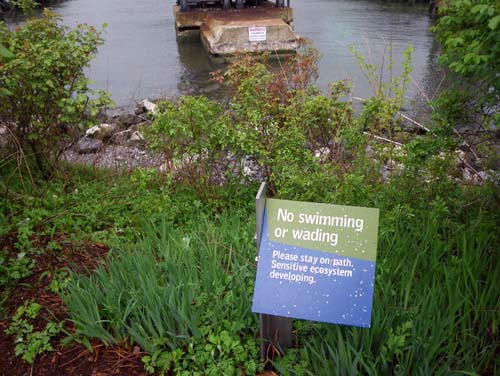
We compared notes on the various waterways of New York as we explored the Nature walk.

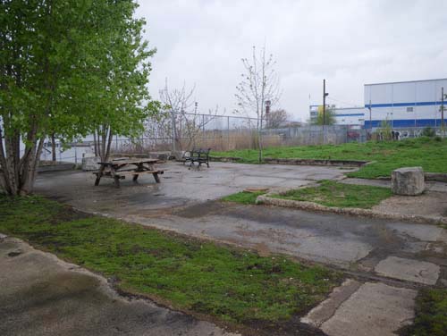
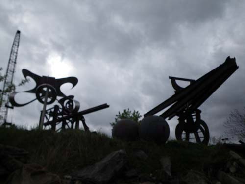
Ben told us that this park was designed by George Trakas,

and he pointed out some of its interesting features,

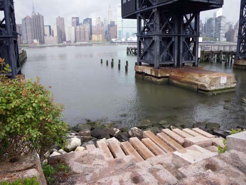
There is a granite map of the old path of the Newtown Creek,

and a garden of indigenous plants.

It was great to meet Mare Liberum and Connie all together and talk about our various interests.

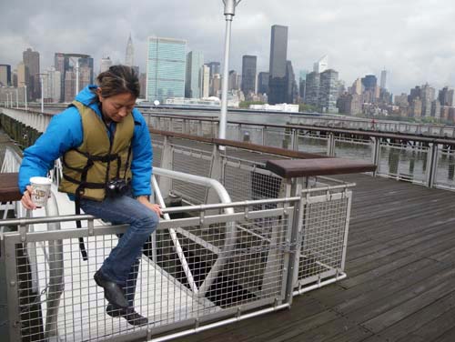
The tide had turned South and we set back out on the river.

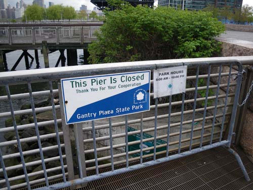
We tried to land back at the East River State Park, but a friendly young man tells us no stopping.

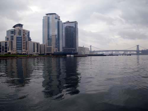
We decided to go all the way to Dumbo,

The wind and waves were up,

but Connie seemed happy to make the trip.

The Mare Liberum boat looked so small against the bridge piers.

That is what we must have looked like too.

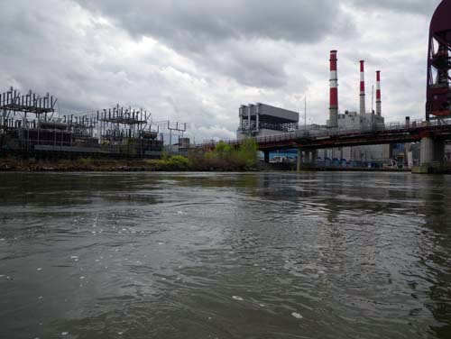
We rounded the eddy after the electric plan,

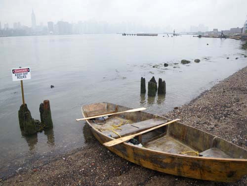
and pulled our boats out of the water.

I was worried about being stopped again by park security, but we laoded the boats without a hitch,

and headed over to the exhibition where Connie had her piece up in a show.

She showed me a flag that she made for our trip,

and a chalk board with a description of the Mare Liberum boat.

On the way back, we dropped off Stephan and Ben at their headquarters on the Gowanus Canal.

It was great to see their fleet of pretty, brightly painted boats.

The best was yet to come.

Connie was actually staying on a houseboat made by her friend.

Connie showed me all the ways her friend has outfitted his home to make his own power, food, and plumbing.

Thanks for the tour Connie – and a great day!

Alexandra Jones and Dan Beard

June 18, 2010

I have always wanted to explore the “Meadowlands” in New Jersey.

I was here once before in a motor boat but never with “The Tide and Current Taxi”.

Alexandra Jones contacted me to propose a trip: Explore the Meadowlands by boat. We would be following in the footsteps of Robert Sullivan, who wrote a book about it in 1998.

With all the new infrastructure for boating, I wondered if this could be a sign of the positive impact of Sullivan’s book.

We left from a pretty little boat launch at the Laurel Hill Park,

and struck off into the heart of the Meadownlands.

For miles around the topography is the same; flat grassy marsh cut through by rivers and highways.

If you fly out of Laquardia Airport, you can see marsh; un-chartable, and moving with seasonal changes in the tide.

From down here, though, it is hard to get your bearing, or even to see over the tall swamp grass.

“We don’t want to get lost.” said Alexandra,

but with markers like I-95 and Snake Hill, we woul always have a landmark to paddle back to.

We decided to drift down the Hackensack for a while.

Dan was visiting from London, and Alexandra wanted to show him the best of New York.

“This is it.” I thought,

as we watched the sun rising over a huge electric plant,

and floated under bridge, after bridge,

after bridge.

From a distance we thought this was a landscape painting stuck to the side of a dock, but on closer inspection – a happy accident of moss and muck.

We watched for a while as an excavator operator deftly shoveled river mud into a barge.

“How many bones do you think he is digging up?” Said Alexandra. The Meadowlands was the alleged burial site of Jimmy Hoffa and others.

At the very least, there are plenty of industrial remains and washed up boats.

We hunted along the bank for a place to penetrate the marsh.

Tiny Fiddler Crabs covered the mud, running back into their little holes as we approached.

I was reminded of the coast of Georgia or North Carolina.

It was hard to distinguish the natural muck from the industrial muck. For instance, what is this black ooze seeping out of the mud?

We cam upon two men in a motorboat, stranded in the muck. They seemed quite content to wait for the incoming tide to release them.

Large groups of turtles (those little white spots up ahead) sunned themselves on the bank. We could never get too close though. Millions of years of evolution have left turtles virtually unchanged because they know exactly when to get back int the water.

We floated quietly over cedar stumps. This marsh was once a forest of cedars. (More info from Robert Sullivan’s book!)

Dan and Alexandra treated me to a part of a delicious turkey Sandwich. It was only 10 a.m. but it felt like lunch time.

Up ahead we spotted a tour boat. The Hackensack Riverkeeper Organization leads tours into this area to bird watch and appreciate nature.

That is great for an area that was considered a garbage dump only a few decades ago.

Now the garbage and nature seem to happily coexist. I mean hey, it’s no skin off the garbage’s back, and certain elements of the natural world appreciate the lack of competition for resources.

“I think the bugs are upping their game.” noted Alexandra.

The temperature was creeping up and the bugs had begun to really bite.

“Home sweet home.” Said Alexandra, and suggested that we all go out for a refreshing drink. We decided that when you start your day at 4:30 a.m. you are allowed to drink before 12.

We had plenty of company at a soccer bar back in Brooklyn!

Carolina Miranda and Jennifer Hsu

June 6, 2010

Carolina Miranda and Jennifer Hsu wanted to make a video about going out in the Tide and Current Taxi.

I wasn’t sure how using the camera would effect our trip,

so we decided to paddle into the Dutch Kills, where I knew the water would be calm and quiet with no other boat traffic.

In fact, there wouldn’t be any boats at all; the dutch Kills is a shallow waterway that separates Randall’s Island from the Bronx, only navigable by tiny boats like mine, and then only at the very highest tide.

I had been there once before, in 2005, and I always wanted to go back.

When we got into the Kills, I realized something very unexpected.

The current was rushing so fast against us that I had to get out of the boat and drag it along the bank.

With Carolina and Jennifer alone in the boat, it became unbalanced, and I had to let go of the rope so that they would not capsize.

Even on such a calm day and in shallow water, we had barely avoided a dangerous situation. My heart raced as I watched them float away by themselves.

We emptied out the boat and walked over the rocks, past the rapids.

This is the area that many trains and highways pass over as they leave New York.

I always love to peer over the side and look down at this world that seems so unlike anyplace in the city.

We rounded the Northern tip of Randall’s Island and looked South toward Hell Gate.

After losing the boat once with Jennifer and Carolina aboard, I decided that we should turn back instead of trying to paddle through Hell gate.

The morning was perfectly still and quiet and we had the entire bay to ourselves.

Off to the West we could see the planes landing at Laquardia Airport and the low, ominous buildings of Rikers Island.

It was strange to be video taped and asked questions as we paddled along. Usually I feel completely unaware of myself in the boat, as I float around and look at the city.

On the way back through the Kills we saw a few families of geese with their newly hatched chicks.

Here is Carolina’s picture of the tiny goslings.

We paddled back under the BQE,

and found the car again on Randall’s Island.

I showed them a map of where we had been, and the charts that I use to tell which way the tide is going. Here is a link to the story that Carolina wrote about our trip:

Yutaka Sho

April 17, 2010

imgp3671.jpg

I have always wanted to go out in the Tide and Current Taxi with Yutaka Sho.

imgp3675.jpg

Yutaka was my roommate in college and now she is an architect. I wanted to see what she thought of all the developments along the Brooklyn waterfront that have happened in the last few years.

imgp3676.jpg

Of all the places that I go in my boat, this area of the East River that has changed the most.

imgp3678.jpg

As the tide pulled us North, we came within sight of the “Williamsburg Edge”, a huge new condominium development.

imgp3680.jpg

“What do yo think of that?” I asked Yutaka.

imgp3685.jpg

“It is like they have lost hope in humanity.” She said.

imgp3693.jpg

We pulled up on the bank of the new East River State Park and took a look around.

imgp3694.jpg

This sign seems to suggest that the rocks are dangerous, but it fairly misses the point. The rocks are not the dangerous part about stepping into the East River- it is the horribly contaminated water.

This is all part of a proposed network of parks and paths that will eventually line the Brooklyn waterfront.

imgp3702.jpg

I like how they have left some of the existing structures of the old piers,

imgp3696.jpg

but I have the distinct feeling that this is not the city’s fully realized vision of the East River State Park.

imgp3705.jpg

It seems like someone is just waiting for permission to complete a solid wall of condominiums like the  ‘Williamsburg Edge”.

imgp3706.jpg

We floated back out into the river.

imgp3709.jpg

We had another hour or two of North-moving tide and I was hoping to see some of the other parks.

imgp3711.jpg

There used to be long cement piers that came out from the shore here, covered with graffiti like that one.

imgp3718.jpg

We floated past where the Greenpoint Terminal Market used to stand.

imgp3727.jpg

Around the Huron Street Pier we could really see how fast the tide was moving.

imgp3740.jpg

We were still being helped along by a few knots of current in the right direction.

imgp3742.jpg

We passed by another big development project in Long Island City.

This one seemed to perfectly represent what I think is wrong with waterfront architecture:

a wall of buildings, a row of benches, then a fence. The message seemed to be that the water is only for looking at.

This dock seemed to be made specifically for pulling up in little boats,

imgp3746.jpg

but signs all around said not to.

imgp3749.jpg

Well, we’ll only be a minute.

imgp3752.jpg

Another inviting architectural feature; pretty stones leading down into the water,

imgp3753.jpg

but signs everywhere say, “no swimming”.

imgp3754.jpg

Maybe the architects were planning with a distant future in mind, when the water will be cleaned up,

imgp3756.jpg

and there won’t need to be so many signs.

imgp3757.jpg

The whole time I kept asking Yutaka what she thought of all this. I wanted an architect to tell me I was right, and that this was bad design.

imgp3763.jpg

She agreed with me to some extent,

imgp3777.jpg

but I realized that these were not the questions most pressing to Yutaka Sho.

imgp3775.jpg

She does most of her work in Uganda and Rwanda, where her NGO connects villages with designers who help develop solutions for better housing.

imgp3778.jpg

She was interested and seemed to be having a nice time, but critiquing waterfront architecture doesn’t rattle her cage as much as mine.

imgp3781.jpg

We took a look around the old small pox hospital on Roosevelt Island,

imgp3803.jpg

and then floated under the 59th street bridge.

imgp3814.jpg

This is the part of the East River where the tide moves most quickly and we talk about the tide turbines that might eventually replace the electric plants like this one.

imgp3816.jpg

We paddled around the bend,

imgp3817.jpg

and Socrates Sculpture park floated into view.

↑ Return to Top of Page ↑