The Aniene starts up around Subiaco. This is the ancient River Arno, that once supplied Roman aqueducts and fertilized the campagna.
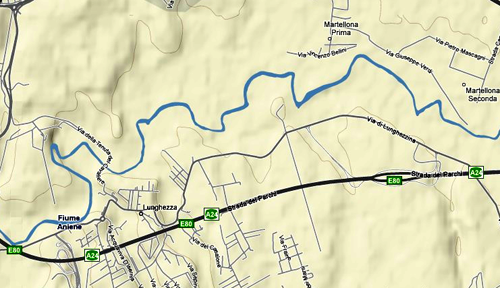
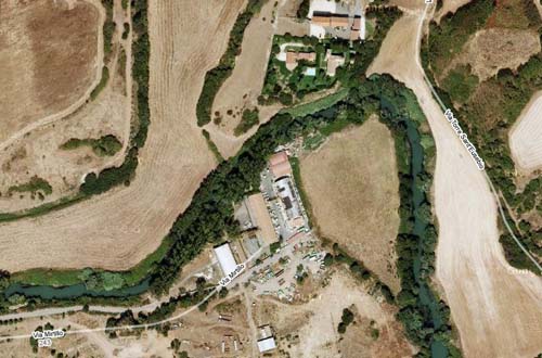
I could see the path of the Aniene on google maps, but it is difficult to actually visit, surrounded as it is by private land and industry.
I wanted to take my boat down the Aniene, but I just couldn’t get a sense of wether it would be safe. Anything could be happening under those trees,
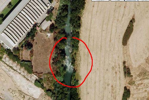
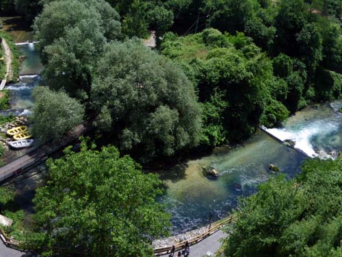
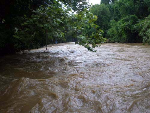
and from these images, it looks like there could be rapids.
In some places, there appear to be fallen trees spanning the width of the river. A ‘sweeper’ is my most feared obstacle in whitewater boating.
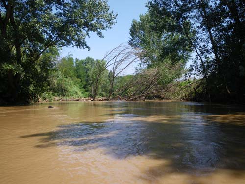
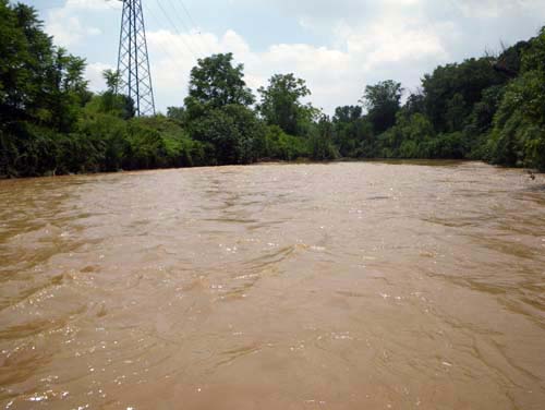
The other thing I noticed while biking to points along the river, is that the water of the Aniene is not white at all, or even green like the google images. It is now brown.
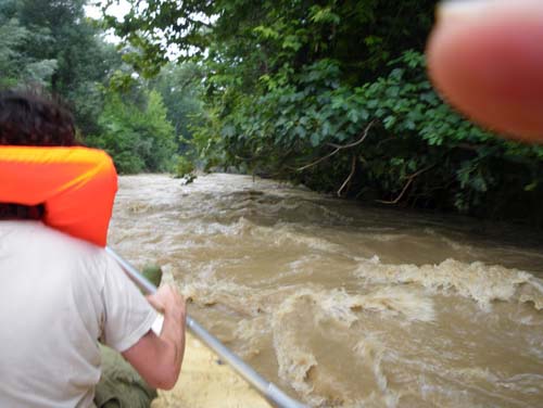
I asked Matt Hural if he wanted to try a trip down the Aniene. “I’ve seen the water, and it could be gross.” I said. “Good.” he said.
“Its weird how you get a few miles outside Rome, and the there is just nothing.” said Matt.
But we weren’t just a few miles outside Rome. Giovanni said later, that we were halfway to Tivoli by the time we found a place to put the boat in the water.
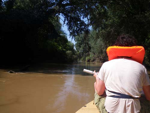
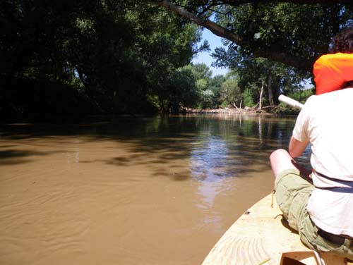
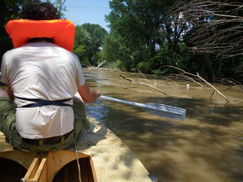
I was nervous setting off. I could barely take pictures as we rounded the first bend.
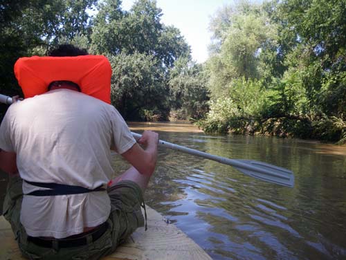
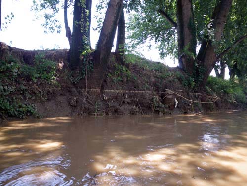
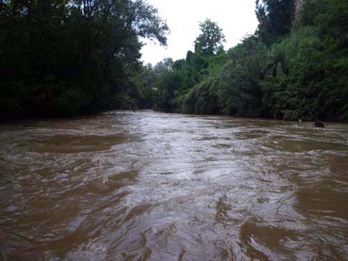
The water was high and running quickly, and although it smelled like a city stream, it was no sewer.
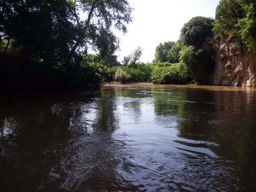
It was quite beautiful with rocky cliffs,
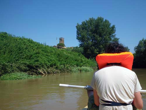
mideaval castles,
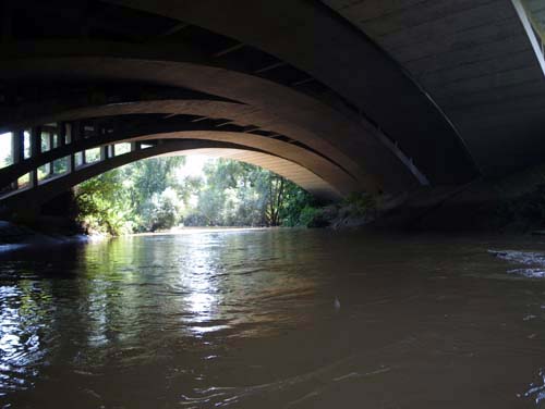
interesting bridges,
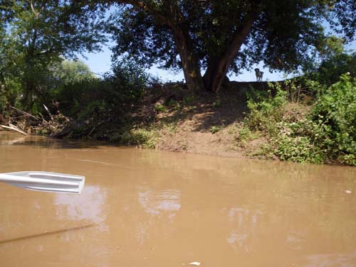
and a shepherd dog who’s flock was peering over the embankment behind him.
The water was high from all the rain the night before.
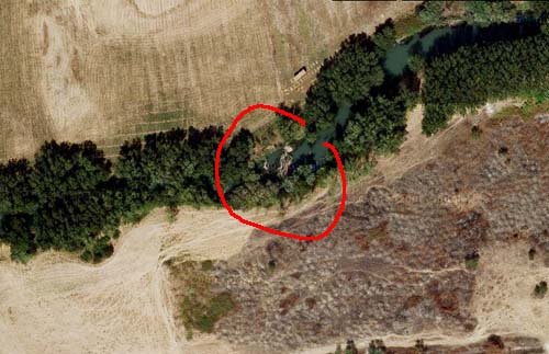
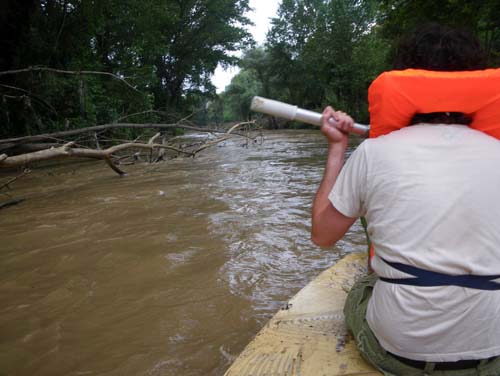
As soon as I relaxed, we saw up ahead the thing that I had most feared. There seemed to be an expanse of debris that stretched all the way across the river; a ‘sweeper’.
The water could be rushing quickly underneath it and the boat could spill over, trapping us underwater with all the other debris.
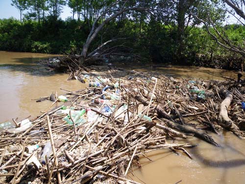
But the river ran deep under the sweeper, and the water was passing gently through.
We were able to pass the boat over the top of the fallen tree,
down into the murkey current on the other side.
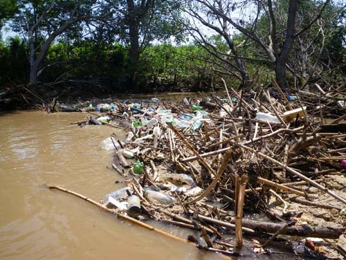
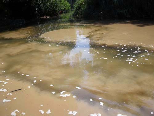
In fact, it was a chance to examine the different kinds of trash being strained out of the current.
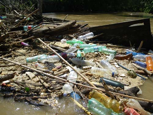
What I thought was pollen on the surface of the water was actually a fine sand of styrofoam covering everything.
We had seen it all along the banks, marking the highpoint that the water reached the night before.
We passed through the stretching arms of trash and trees,
and out of the range of the sweeper.
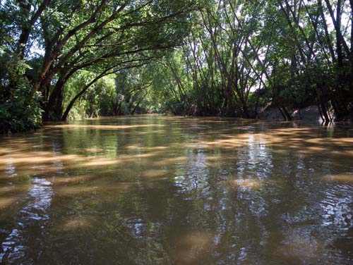
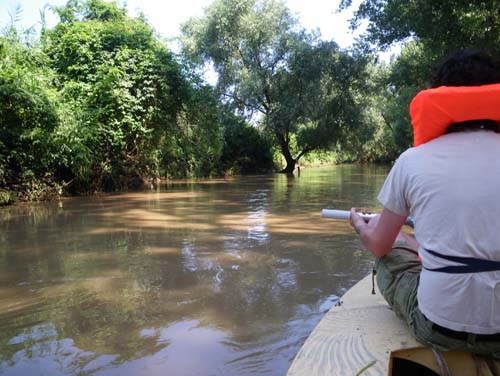
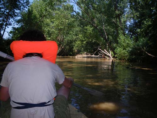
We were now in an area completely covered by trees; one of the other things that had concerned me from the maps.
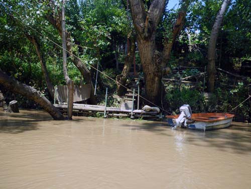
But as we passed more and more boats tied up at the banks, I figured there were no waterfalls or serious rapids.
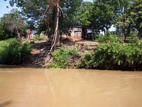
We seemed to be in an agricultural area, and small pens of livestock lined the banks.
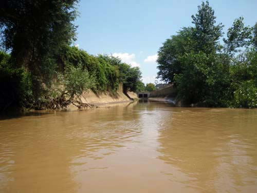
There were also massive outlets for sewer overflow.
At one outlet, we observed that the water coming from the sewer was actually clearer than the Aniene.
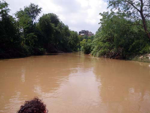
As the first signs of the city floated into view, I began thinking of my favorite analogy for navigation; time travel. We had passed mideaval towers and hamlet farms,
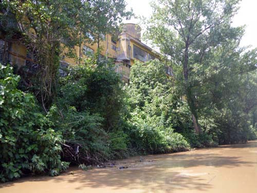
we began to see huge relics of Rome’s industrial past,
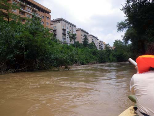
and then 60’s block housing.
We seemed to float forward in time as we entered the city.
We had been on the river for 4 hours, covering half the distance of the navigable part.
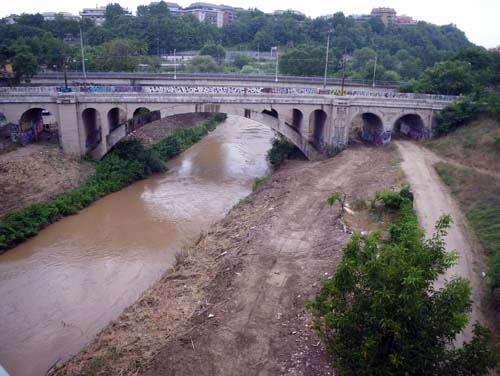
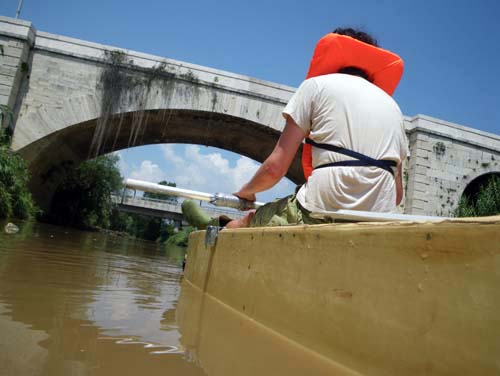
Then, around the bend came the first recognizable sign of Rome;
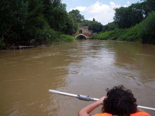
the Ponte Nomentano, one of the oldest bridges, spanning the Aniene in much the same form for 2000 years.
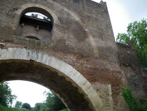
It was a sudden loop in my future-flowing revery, and a beautiful monument to Rome’s architectural strategy
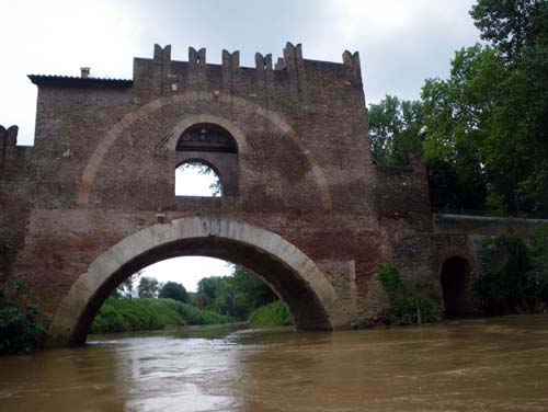
of devouring itself as it serves.
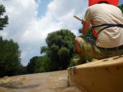
But below the bridge, the water became turbulent.
It wasn’t just the fear of capsizing, but the fear of even touching the water,
that had my heart racing.
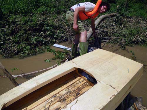
When we passed the rapids we looked for a place to pull over;
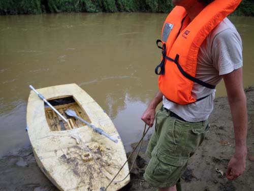
a muddy bank.
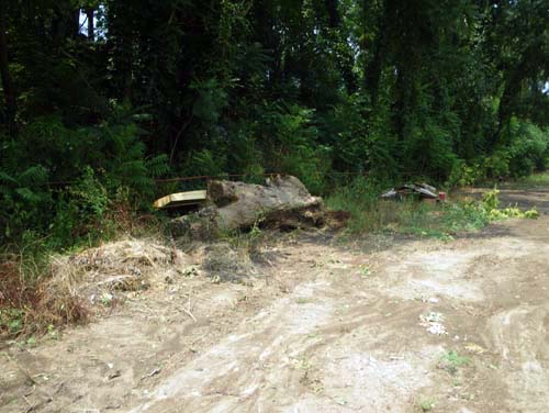
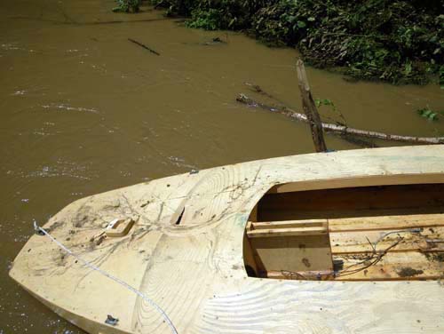
We hid the boat in the trees,
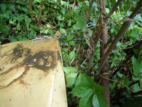
and locked it to a rail.
We left it for another day.
↑ Return to Top of Page ↑